Scuba Diving Day Trips from Khao Lak - Similan Islands Dive sites and Wreck Diving
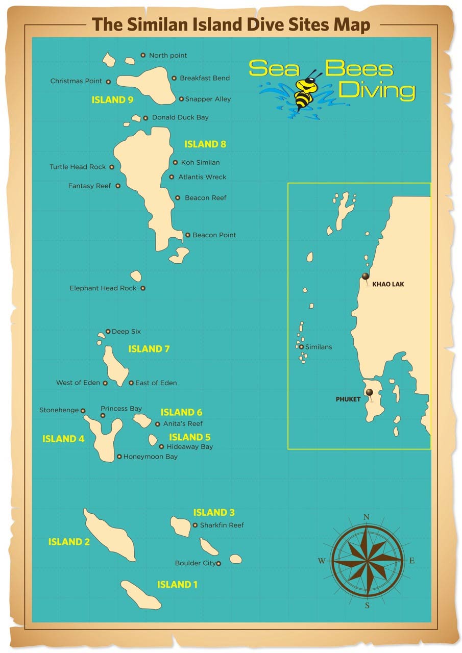
Khao Lak Dive Site Information
Planning a dive trip in Khao Lak?
Here you will find information about the dive sites we have selected!
Our Khao Lak Day Trips
WORLD FAMOUS SIMILAN ISLAND & WRECK DIVING SITES
A guide to the best sites in Thailand
![]()
The Similan Islands Dive Sites
![]()
Shark Fin Reef
Shark Fin Reef is a formation of boulders and hard corals which is1 km to the southeast of Island 3. The site itself is approximately 1 km long and lies from the northwest to the southeast. Normally 3 pinnacles can be seen from the surface, which gives the reef the name, Shark Fin Reef. But these pinnacles are difficult to see during high tide.
The vast majority of the site is occupied by boulders that fall steeply to 35 – 40 meters and are surrounded by sand. Due to the fact that the boulder formation is long, coral reefs have been divided into northern and southern areas. Both areas are steep and cliff like. The southern side is deeper than the northern side.
The northern area has more corals consisting mostly of staghorn coral and soft corals, combined with tiny rocks and sea fans. The southern side is made up primarily of sheer walls.
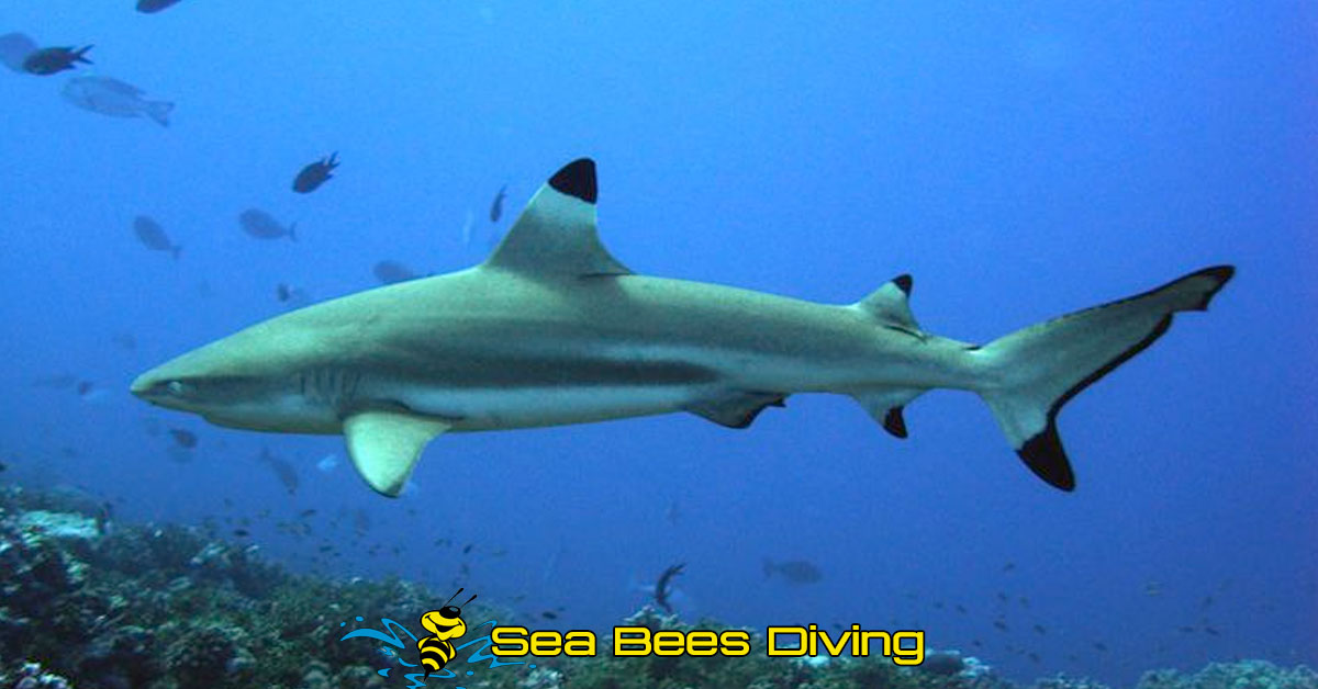
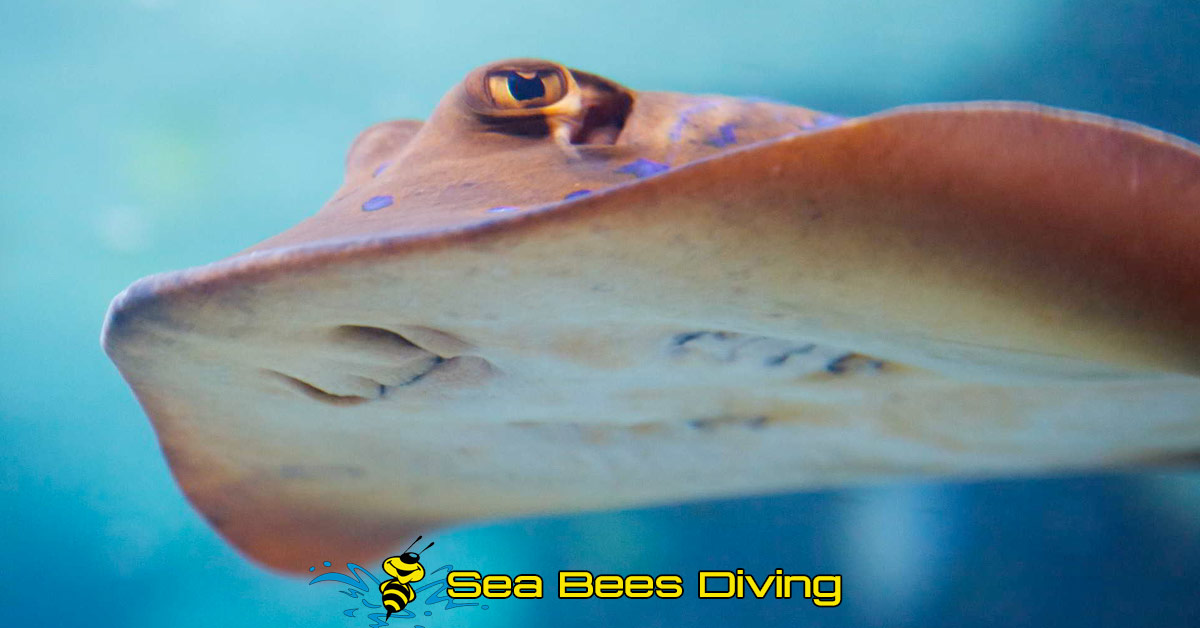
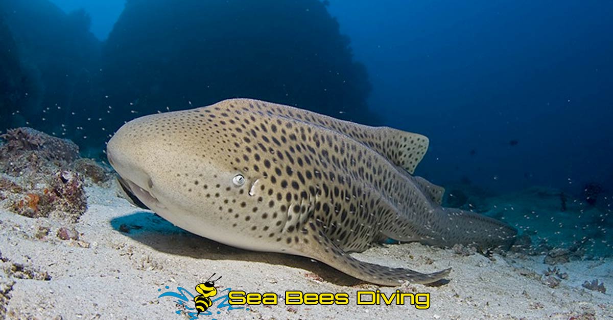
Near the sandy areas, you are likely to find leopard sharks, whitetip and blacktip reef sharks, stingrays and spotted garden eels.
Furthermore this is one of the few areas in the Similans where you can see Napoleon wrasse and hump head parrotfish. Bigger-than usual adult cube box fish are often seen, particularly in the shallow waters of the east. Among the boulders, a lot of camouflaged marine life can be seen, including octopuses and devil scorpionfish.
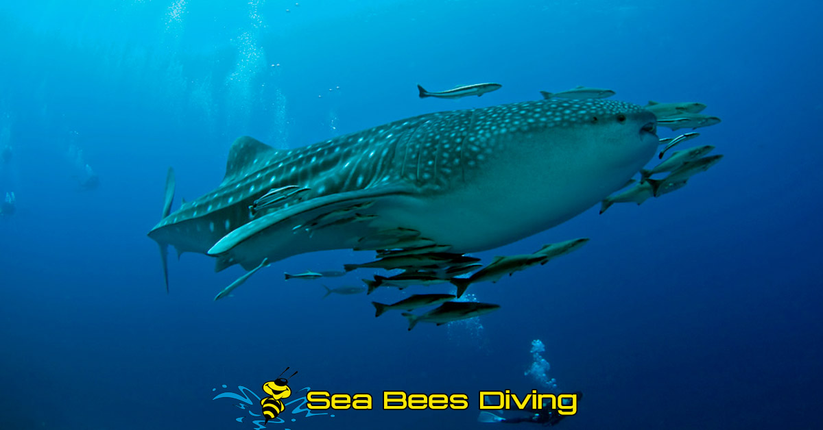
Pelagic fish that can be seen are bluefin trevally, giant trevally and tunas. Manta rays can be spotted during winter and whale sharks have been reported in the vicinity as well.
![]()
Honeymoon Bay
The reef is located to the east of Island 4 in front of Haad-Lek, the small beach. The bay is ideal for mooring at night. Corals line up from north to south, and gently slope down from 5 to 10 meters to a depth of 26 meters at the sand bottom. However, the average depth is only 15 to 20 meters. Most of the reef has hard corals, which are mostly Staghorn coral and Pore coral. There are also some groups of rocks with soft corals.
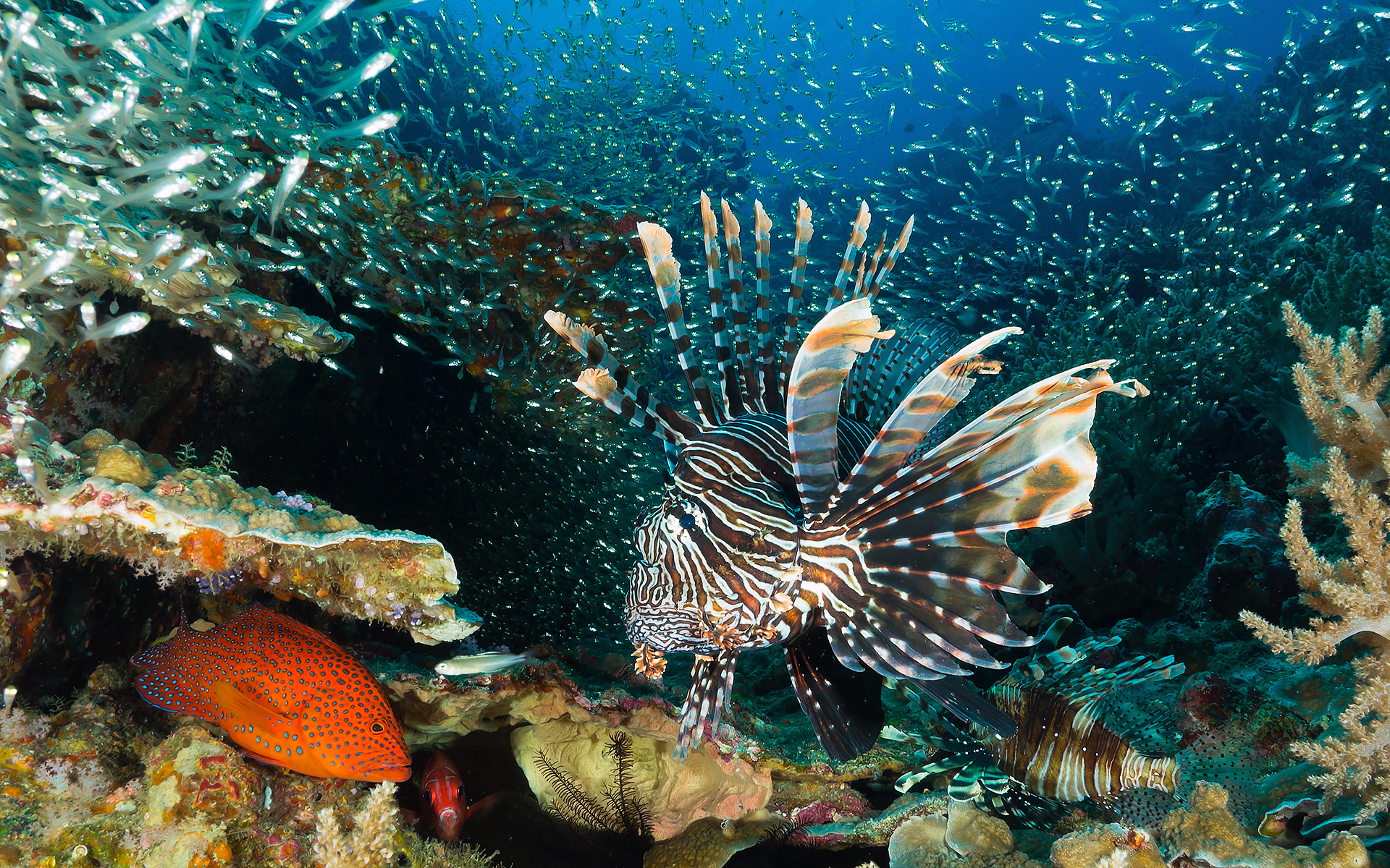
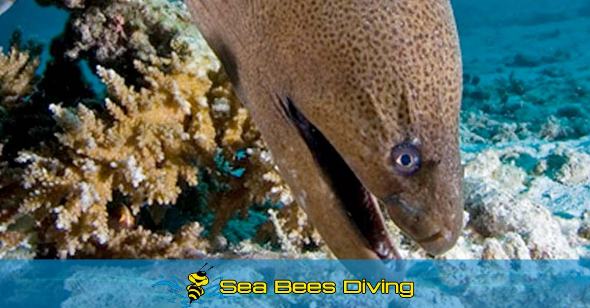
On the sand bottom on the outskirts of the reef, stingrays and garden eels can be seen. On occasion, gig rays like the Jenkin’s ray can be seen. Along the reef, many small reef creatures appear, including lionfish, boxfish, angelfish, butterfly - fish and moray eels. Special creatures such as twin spotted lionfish have also been seen.
![]()
Anita's Reef
This site is also called Barracuda Point, but barracudas are rarely seen here. The reef spreads across 2 islands, Similan Island 5 and 6 which are two minor islands adjacent to one another. The reef starts from east of Island 6 and runs to south of
Island 5. The reef slope falls from the reef flat of 5 to 10 meteres to the sand bottom at a maximum of 26 to 28 meters. Shall coral gardens comprise huge pore or staghorn corals with small pinnacles. Colorful corals are scattered along white powdery sand, creating beautiful natural scenery.
A big outcrop located on the southeast makes this dive site unique and attracts many photographers. From the sand bottom base at 20 meteres to the top of the rock at 12 meters, this fantastic rock is surrounded by various colorful soft corals,
gigantic sea fans and many species of hard corals. The Thai name for this spectacular rock is ‘Hin Muan Deaw’ is the best way to describe how beautiful this rock really is. ‘Hin Muan Deaw’ directly translated means ‘Whole roll of film rock’ as one can use up to an entire roll of film solely on this rock. It really is a must see.
At the south side of Anita’s reef are gigantic boulders that extend from Island 5 and continue southward. These gigantic boulders lie at 30 to 35 meters on a sand bottom and have formed a channel that divers can swim through.
In 2003 the Similan National Park authorities sank a 12 x 30 meter fiberglass fishing boat in the area to create a new diving spot. The Tuna Wreck, as it’s known, is located near of Island 5, just pas the southeast corner, and is marked by a buoy. The wreck sits on the sand bottom, just beyond the reef edge, with adepth varying from 40 meters at he deepest to 28 meters at the top of the wreck.
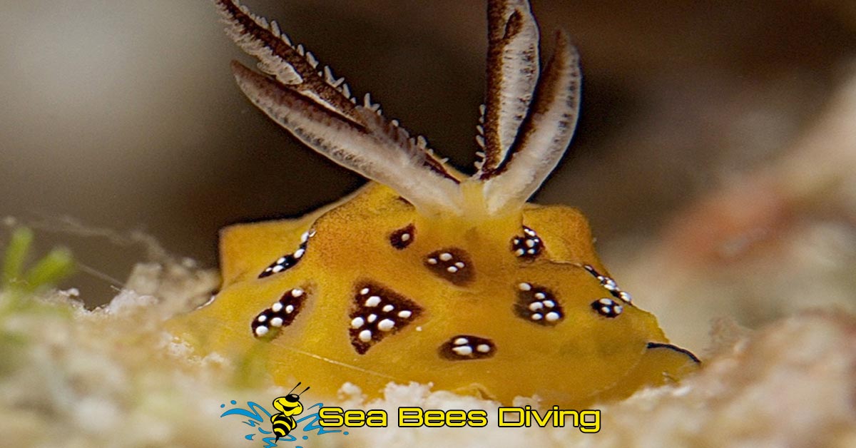
Some rare species such as black ray partner gobies can be spotted on the sand bottom. Razor wrasse and rock mover wrasse can also be seen here. In addition, angelfish, dragonets, pipefish, scorpion fish and varieties of colorful nudibranches are commonly seen on the rocky reef. Furthermore, clown triggerfish, octopuses and sea snakes have been spotted. In the mornings on thereef, you will find blue fin travelly, long nosed snapper ad goatfish hunting schools of tiny fish. Also, in the south, in the area with big boulders, sharks can sometime be spotted. A number of big Kuhl’s stingrays can easily be seen. Turtles are common, too. Ghost pipefish can occasionally be seen during March and April. Large schools of batfish hang around Tuna Wreck.
![]()
West of Eden
When East of Eden became too crowded, some divers looked for a new dive site nearby. They went to the west side of Island 7 and discovered that the Garden of Eden is not located only on the eastern side.
Like other western dive sites at the Similans, West of Eden basically compromises giant granite boulders that create nice canyons, with walls covered with soft corals and giant sea fans. Some areas are characterized by rubble and sand slope falling to a depth of 30 to 35 meters. The shallows are home to many reef fishes and have stacked granite boulders covered with hard corals, soft corals, gorgonians and feather stars.
The wall and small rocks are encrusted with soft corals, gorgonians, sponges and algae.. This area is a nice place to look for macro subjects like nudibranches and frogfish. Keep an eye out for cleaner pipefish and many banded pipefish in small crevices, as well as long-nose hawkfish perched in black coral bushes. The rubble and sand slopes are a good place to search for ribbon eels, dragonets and red fire gobies. Back at the reef, moray eels are quite common, as well as turtles and schools of angelfish. Occasionally, whitetip reef sharks cruise by. In strong current, schools of bluefin fravelly, giant travelly and fusiliers come more active.
![]()
Deep Six
This cluster of submerged boulders is located on the north of Island 7. Deep Six is an extension of the main island that continues underwater, with a max. depth of 35 to 40 meters. There are many outcrops throughout the area, along with scattered rocks with soft corals and sea fans on the outer parts. At the big boulder in the center, a pile of smaller rocks form swim throughs, at depths between 12 and 22 meters. In addition, there are sheer walls covered with dense soft corals. Shallow patch corals and rocks surround the island at a depth of 10 to 15 meters.
You may see whitetip reef sharks off the boulders, and Kuhl’s stingrays are common on the sandy areas. You will find black and white snapper, giant travellies and tuna swimming among the boulders, as well as schools of neon fusiliers, bluefin travellies and yellow snapper. When passing the swim-throughs, you may encounter big snappers, oriental sweetlips or harlequin sweetlips, and if you are lucky, you will spot ghost pipefish and frogfish camouflaged among the pinnacles. The lush corals are home to various small marine critters such as red fire gobies, blennies and nudibranches.
![]()
Donald Duck Bay
A famous view point in the Similans, Donald Duck Bay has a rock that looks like a boot or a duck’s head, depending on who is looking and describing it. As this is where the National Park office is located, there are always many boats moored around this bay. Although there are many tourists, conditions under water are fine for diving and snorkeling, particularly in the northern side, which has a few exposed rocks that extend away from the island. The outer sand depth is about 20 meters. Around the pinnacles is an area of flat sand and few corals. The rocky areas have soft corals. The rocky areas have soft corals and sea fans, particularly the outer pinnacles to the southwest. In addition, there are some swim-throughs on the western side.
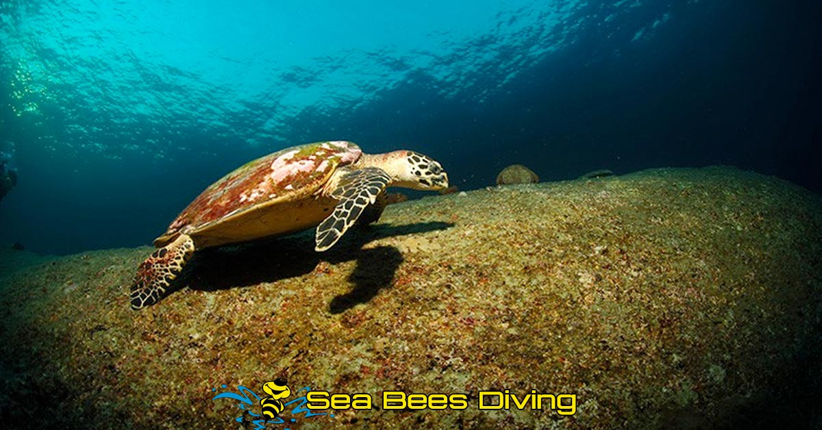
This site has many sea turtles, which may attempt to ask for food from tourists. Please do not feed them, as this may change their natural behaviour and ability to be auto sufficient in the long run.
![]()
Turtle Head Rock
Turtle Head Rock comprises a coral community on the rocky coast and patched reef located to the west of Donald Duck Bay. The site’s landmark is a rock shaped like a turtle. Turtle Head Rock consists of stacked rocks and staghorn coral stretching along the edge of the island. The sand bottom is at 25 meters. The average depth of the rocky area is 15 to 20 meters. North of the rocky area is a shallow part that is 8 to 10 meters in depth. There is also a swim-through here.
On sandy bottom, Kuhl’s stingrays and garden eels are common sight. Nestled within the crevices of the rocks, you are likely to find several kinds of sweetlips, snappers, groupers, angelfish and moray eels. Also, various small creatures like nudibrach and squat lobsters. Sea turtles are often seen here, too
![]()
Waterfall Bay
A small bay south of Turtle Rock, Waterfall Bay has a tiny waterfall starting from the top of the hill in the rainy season that allows boats to refill water but dies not supply enough water during dry season. The coral reefs slope down to a max. depth of about 20 meters. The average depth is 10 – 15 meters, and there is an abundance of hard coral, such a pore coral, stag horn coral, table coral and brain coral. The north of the bay is made up of large rocks and soft corals that continue to all the way to Turtle Rock.
Reef fish and sea turtles are common. At night, creatures that are often seen include big lobsters, coral crabs in crevices, as well as parrotfish sleeping in mucous cocoons in an attempt to protect themselves from predators like giant morays. Some of the smaller creatures include anemone crabs, boxer shrimp, nudibranchs and flatworms. You may see nurse sharks on occasion.
![]()
Christmas Point
Christmas Point is a cluster of submerged boulders, with the exception of a pinnacle at the surface that is located on the northwest ridge of island 9. Underwater, there are a number of large stacked boulders that stretch from the island to a depth of 35 to 40 meters, which create an arch – a swim through at 24 meters. The crevices are covered by colorful soft corals and sea fans. In the northeast, there is a mooring line tied to the top of the pinnacle at a depth of 14 meters. To the north of it, there is a ridge of huge boulders that falls to a depth of 35 to 40 meters. There is a sand area in the west with small rocks along the way. A hard coral garden made up of rows of staghorn and pore coral is located at a shallow depth of 10 meters.
Around the borders of the rocks and beyond, at a depth of 25 to 40 meters, you are likely to find leopard sharks, whitetip and blacktip reef sharks and other big fish such as Napoleon wrasse, great barracuda, giant travally and tunas. At the swim-throughs, giant sweetlips and groupers can be seen hiding in the crevices.Schools of fish, including bluefin trevally, neon fusiliers, goatfish and long nosed emperors are frequent visitors. Many small fish such as purple fire gobies and red fire gobies are familiar sight here. Ribbon eels, a rare species, camouflage themselves on the sand like whip corals, can also be found. It is possible to spot manta rays passing by as well.
![]()
Rocky Point / North Point
These submerged rocks are located to the northeast of Island 9 or north of Breakfast Bend. Marked by a buoy 1 kilometer north of the island, the huge boulders are surrounded by large areas of sand. The northern boulders extend to below 35 meters. The formation of adhering rocks create holes and a swim through at around 20 meters. Remarkably, in the southern area, a steep gigantic boulder forms a scenic, elongated channel 5 meters below surface, that runs from east to west. Next to the channel, near the island are shallow fringe reefs that consist of staghorn and hard corals, stretching all the way from the northeast to the southwest.
About 300 meters to the northwest of the site lies another pinnacle that is totally covered with soft corals and giant sea fans. However, the top of the pinnacle is about 30 meteres and falls steeply between 40 and 45 meters, which is deep for recreational diving. Please note that there is no shelter between this pinnacle and the shallower site, so heading back from the pinnacle may not be a pleasant swim. However, you may be rewarded with a sight of leopard sharks in the sand.
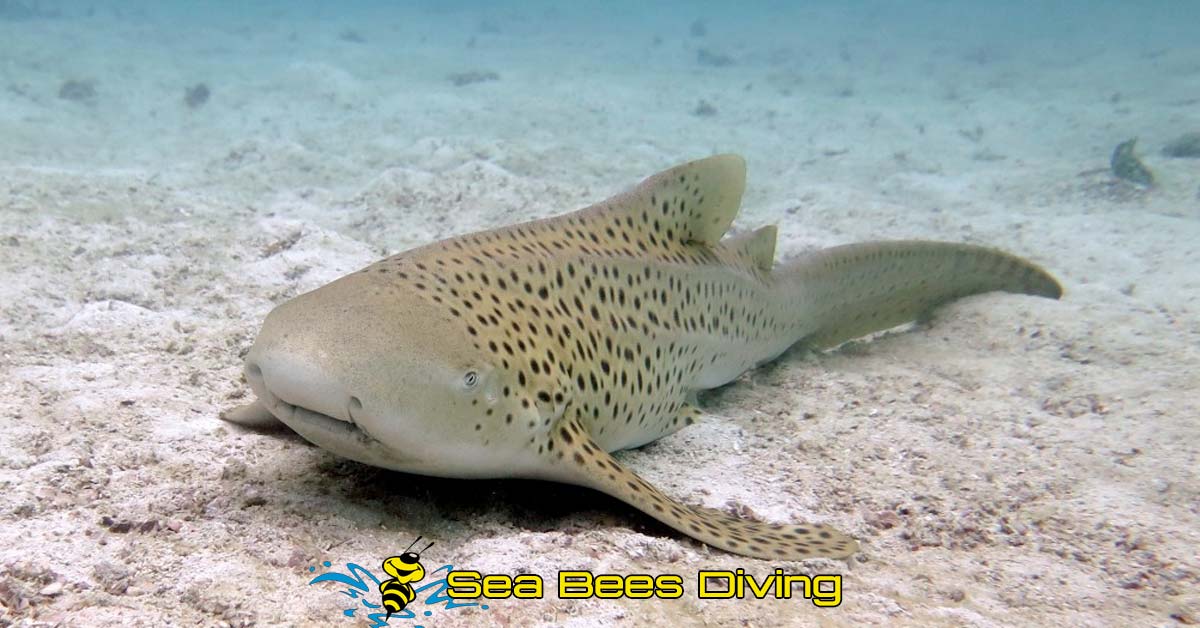
Resting on the sand, sometimes close to the boulders are leopard sharks and whitetip reef sharks. Besides the sharks, the sand is also habitat for many gobies and shrimps. In addition, Kuhl’s stingrays are always found buried under the sand. Schools of giant trevally, bluefin trevally, goatfish, surgeon fish and unicorn fish often visit this site. Many of smaller creatures that appear here include nudibranchs, pipefish, purple fire gobies and octopuses. Lastly, near the shallow hard corals, divers usually have the opportunity to encounter turtles.
![]()
Breakfast Bend
East of Island 9, stretching from the north to the south, a very long coral reef slopes gently from a depth of 5 to 10 meters, falling to a sand bottom of 25 to 30 meters. The main feature is hard corals such as pore coral, staghorn coral andbrain coral, while soft corals here is hard to find. There are also white whips in the north.
Leopard sharks are common and sometimes two to three of them can be seen at the same dive. Seeing whitetip reef sharks and Napoleon wrasse is possible here, Kuhl’s stingrays, garden eels. Groupers and triggerfish, as well as different kinds of gobies on the sand are common sight. This site is also home to schools of soldierfish and and bluefin trevally, as well as some camouflage experts such as octopuses and ghost pipefish. Furthermore, comet fish can also be seen sometimes in rock crevices. On the northern side, large swarms of friendly batfish and yellowtail barracuda can always be found swimming around. This site has many interesting species and is not deep.
Koh Bon Dive Site
![]()
Koh Bon
Although this granite islet is isolated to the northwest of the Similan Islands, Kho Bon is still considered to be part of the Similan Islands National Park. One favorite dive spot is the western ridge of the island, which falls steeply to the deep sea. Above the surface, there is an opening where you can walk through to the other side. Diving boats usually park in the bay located south of the ridge, where they have maximum protections against wind and strong waves.
Underwater topography in the southern bay comprises hard corals including mountain coral and brain coral. The western ridge continuous from the mainland out to the sand bed to a depth of more than 25 to 40 meters. The walls are decorated with various colorful soft corals and few hard corals. From the ridge to the northeastern side are reefs that stretch along the island.
The reef slopes froom a depth of 10 meters down to a sandy bottom at 25 to 30 meters. The majority of corals here are hard corals including staghorn coral and brain coral that are interspersed with few big coral heads. Soome areas are made up of flat pains with sparse coral.
800 meters to the northwest of the island, there is a submerged pinnacle, which is sometimes marked by a buoy, although this is often washed away. Thus, a depth finders is essential here. The pinnacle is at a depth of 18 to 45 meters and covered by an abundance of yellow soft corals and large sea fans.
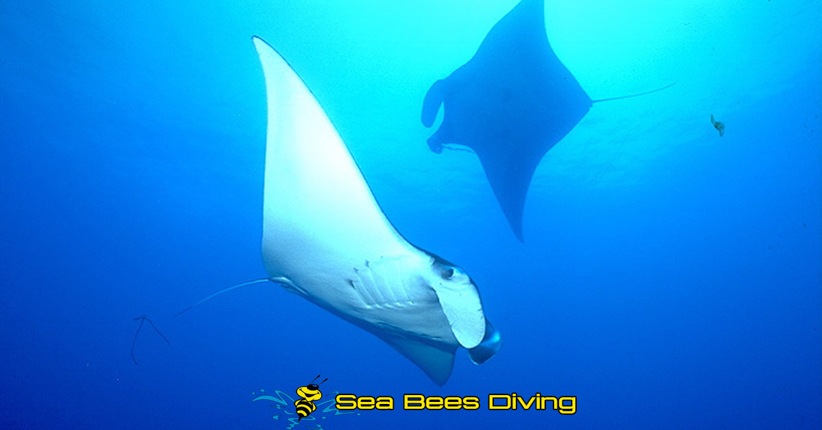
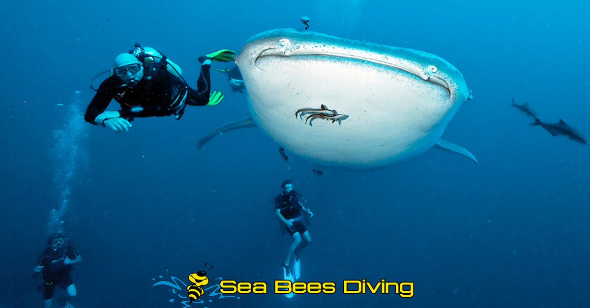
This site is a cleaning station for manta rays, so there is a high chance of finding at least one during a dive, particularly at the western ridge and the northeastern outer reef.
Koh Bon also has many kinds of sharks, such as leopard shark, whitetip and black tip reef sharks. Sometime grey reef sharks swim by and nurse sharks can be seen laying under coral heads.
Schools of yellow tail barracuda, fusiliers, trevallies, sweetlips, and black and white snappers are all common in the area, as well as octopuses, sea snakes and nudibranchs. Manta rays have a distinct circling behavior when feeding on plankton. You can experience and see this for yourself unless you chase them or swimming to close, which may make them panic and swim away. Chasing them also wastes your air supply and reduces the chances for other divers to encounter these spectacular creatures.
Khao Lak Wreck Diving Sites
![]()
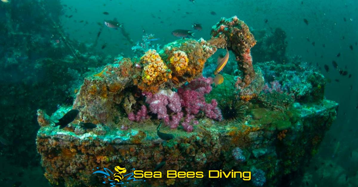
Boonsung Wreck
A tin dredger called Boonsung sank around 20 years ago. It is located to the west of Bangsak pier, about 7 nautical miles offshore or about 13 nautical miles from Tab Lamu harbor. It is a favourite destination for half day trips, that depart from Khao Lak. The wreck lies on serene flat sand at 16 to 20 meters. The wreck is around 10 meters wide and 30 meters long. The average roof level of the wreck is at 13 to 16 meters and the highest part of the wreck is at about 12 meters of depth. After Tsunami the wreck has been broken into 5 parts, All are fully covered with barnacles and sponges and only a few can be seen here. Sometimes you can see the remains of a fish cage near the wreck.
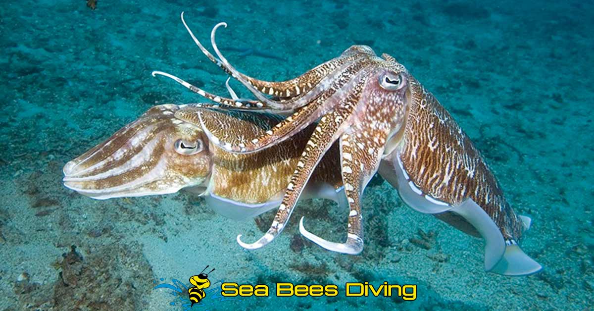
Although Boonsung is a small site, tones of fish gather around here, such as schools of bigeye trevally, snappers and batfish. Also big schools of porcupine fish and squid can be seen lingering around. On the sand floor you can sometimes see leopard shark, a variety of gobies and tiny flounders and flatheads wedged in the sand. Hiding beneath the wreck in the dark, divers have often seen huge marble stingrays. On the wreck itself, you can find a great selection of nudibranches that brighten up the full wreck. Moray eels, including the white eyed morays and honey comb morays with spectacular patterns that are rare at other sites can be seen emerging from almost every crevice. Cuttlefish, octopuses and pipefish can also be seen. If you are fortunate enough, you may encounter whale sharks, specially in the month of March.
![]()
MV Sea Chart 1
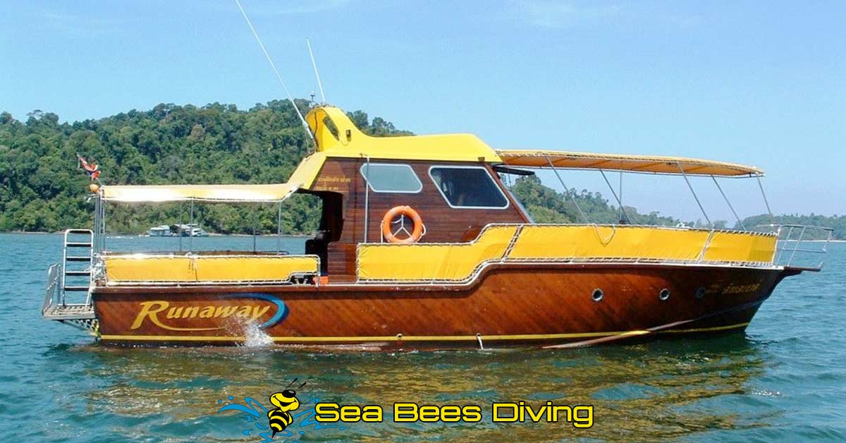
Every Wednesday Sea Bees Khao Lak offers for experienced divers a new wreck diving adventure. With our boat ‘Runaway’ (max. 12 divers + staff) we go out to explore the MV Sea Chart 1 which sunk in August 2009, not far away from
Tab Lamu harbor. The vessel is lying on the sand on his starboard side, in depths between 28 meters and 40 meters and offers a breathtaking dive. The wreck is a little more than 80 meters long and about 12 meters wide, though it is still a pretty
‘young wreck’, already an abundant variety of marine life can be found. The second dive of this day trip will take place at the Premchai Wreck, a relict from the tin mining area around Khao Lak, which allows us, because of the shallower depth (15 meters to 20 meters), a comfortable 2nd dive of the day.
Minimum pre – requisites to join this trip are an AOWD – level or equivalent, 100 logged dives, whereof the last dive is not longer ago than 12 months (don’t forget your log book!) . This is also a perfect day for diving with Nitrox or to start your Deep Diver Course.
![]()
Contact us direct right now!


Talk to See Bees Diving Now!
General information - Khao Lak Dive Sites
The dive sites in Khao Lak range in difficulty from easy to medium with maximum depths of 18 to 40+ metres. The dive sites at Koh Bon, and the wreck dives, call for more diving experience than beginner levels.
The Similan Islands dive sites are the main attractions from Khao Lak
As you will have read above they offer many and varied dive experiences with caves, swim throughs, overhangs and steep walls as well as the very impressive rock formations both above and below the water.
Local wreck diving in Khao Lak - wrecks with plenty of sealife
Many diving visitors choose to try the local wreck dives and agree that they are excellent dive sites in their own right.
At Sea Bees Diving Khao Lak we run dive trips to these wreck sites 6 times weekly aboard our own dive boat MV Runaway.